Using Drones and Science to Tackle Wildfire Risk in Waikōloa
We know firsthand how urgent the wildfire threat is here at the Wildfire Safety Advocates. Our home community in Waikōloa sits in the middle of some of the most flammable landscapes in the state of Hawaiʻi, surrounded by invasive fountain grass and exposed to strong winds that can turn a small spark into a fast-moving disaster. With only one main road in and out, residents live with the knowledge that a single fire could threaten thousands of lives.
To meet this challenge, we’ve been pursuing funding from multiple sources to launch a groundbreaking project: deploying high-end agricultural drones with multispectral cameras and advanced mapping tools to understand wildfire risk like never before.
Mapping the Fuel That Drives Fires
Invasive grasses are the raw fuel that make Hawaiʻi’s wildfires burn hotter and spread faster. By using multispectral sensors, we can identify the spread of invasive species, measure vegetation health and water content, and characterize the fuel load across thousands of acres. This allows us to identify exactly where conditions are ripest for ignition; the hotspots where fire is most likely to spread.
Building a Digital Twin of Waikōloa
Beyond simple maps, our vision is to create a digital twin of the region —a living, 3D model of our community and its surrounding grasslands. With this model, researchers and emergency planners can simulate how fire would move under different wind and weather scenarios. It’s a tool that can guide where to place firebreaks, how to plan evacuations, and which areas need the most urgent vegetation management.
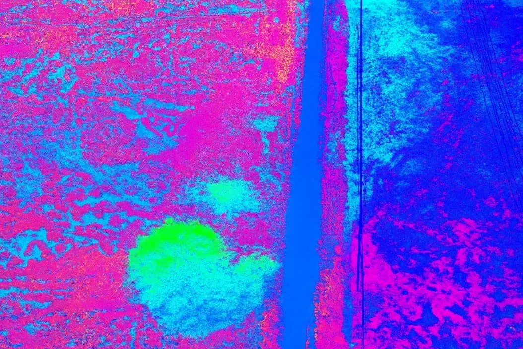
Sample Multispectral Image
Open Data for Action
The results won’t just sit on a shelf. All maps and models will be made openly available, so local leaders, residents, scientists, and policymakers can use them to take informed, science-based action. By pairing cutting-edge technology with grassroots leadership, we aim to close the critical data gap that has held back science-based wildfire planning for years.
Looking Ahead
By piloting this approach in Waikōloa, we hope to create a model that other fire-prone communities, from the American Southwest to Australia, can adapt. With every flight, every map, and every meeting, we’re moving closer to a future where residents don’t just fear the next fire, but are prepared to face it together.