Mapping Our Escape: New State Report Exposes Critical Gaps in Hawaii's Evacuation Plans
Article Summary.
"Hawaii wildfire emergency evacuation routes" (Hawaiʻi Public Radio, July 29, 2024)
A recent Hawaiʻi Public Radio article breaks down a pivotal new report from the Hawaii Emergency Management Agency (HI-EMA) that audits the state's wildfire evacuation route plans. The investigation, prompted by the tragic events of the Lahaina fire, reveals a fragmented and inconsistent system across the counties.
The key finding is that while some counties have identified primary evacuation routes, there is a severe lack of public signage, official mapping, and public education about these routes. The article highlights that many designated routes have not been physically assessed for their wildfire resilience—such as width, vegetation overgrowth, or the number of lanes—to determine if they can actually handle a mass evacuation under dire conditions. Importantly, the report concludes that the state currently lacks a unified standard or dedicated funding for improving and maintaining these critical lifelines.
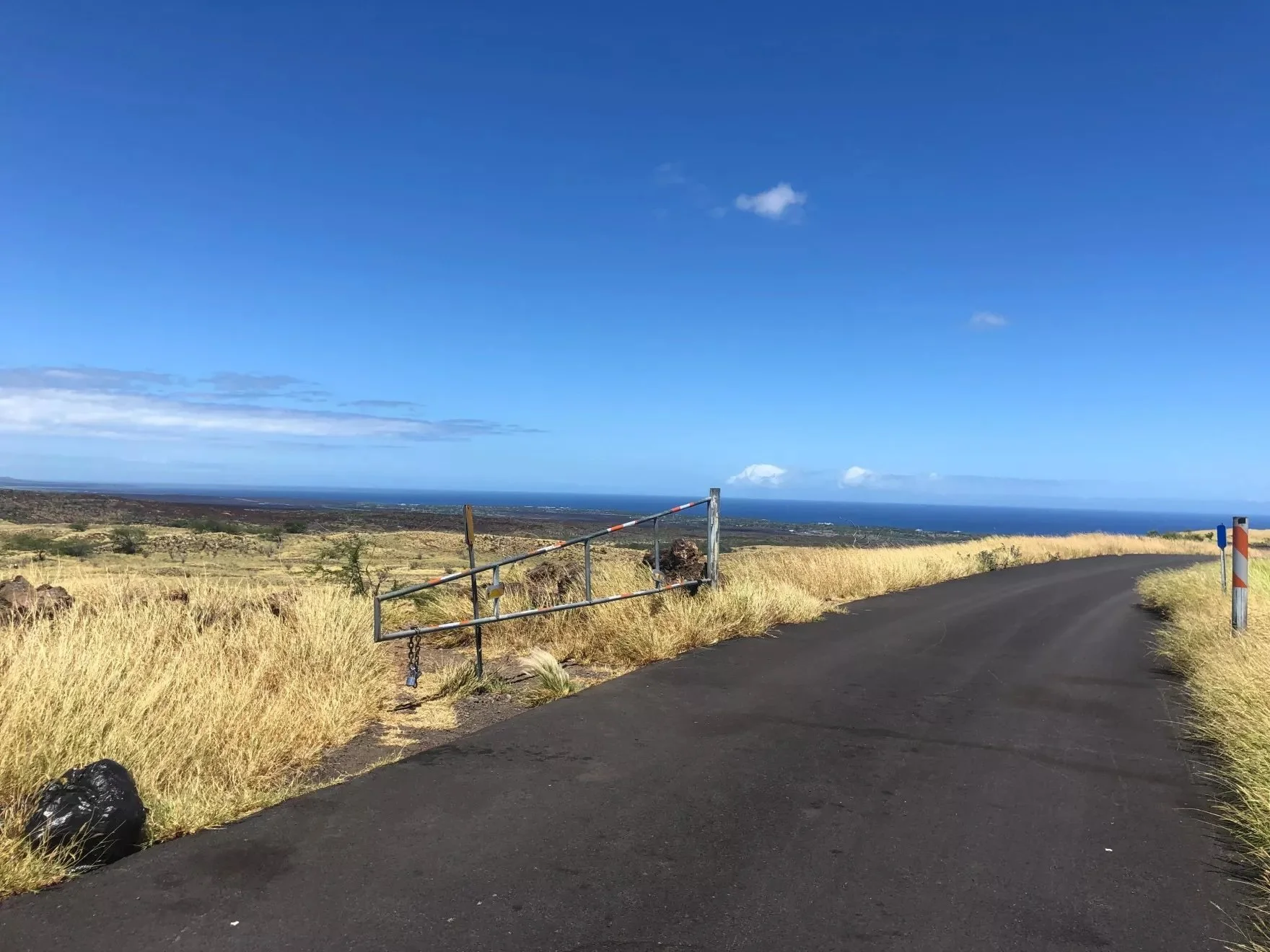
Gated entrance to the Waikoloa Village Hulu Street Evacuation Route. A one-way, single lane emergency egress.
Our Thoughts as Wildfire Safety Advocates:
A Long-Overdue and Sobering Reality Check: This report confirms what our advocacy group has long feared: the planning for a large-scale wildfire evacuation is dangerously inadequate. For those of us in Waikoloa, where the limitations of our two-lane roads are a daily reality, this is not an abstract concern. The lack of signage is particularly alarming; in a smoke-filled, high-stress emergency, residents and visitors cannot be expected to guess the safest way out.
Assessment is the Essential First Step: The report’s revelation that many routes haven't been physically vetted for fire-specific risks is a critical failure. An evacuation route is useless if it is likely to be blocked by falling embers, downed power lines, or overgrown vegetation. We strongly endorse the report's recommendation for immediate, on-the-ground assessments of all designated routes in Waikoloa and across the state. We need to know not just where the roads go, but if they will be passable during a fire.
This Must Lead to Action, Not Just Another Report: Awareness is the first step, but it cannot be the last. This HI-EMA report must serve as a definitive catalyst for change. We call on our county and state leaders to use these findings to:
Secure immediate funding for the installation of clear, standardized evacuation route signage.
Conduct a thorough assessment of Waikoloa's evacuation routes, publicly sharing the findings and a plan to mitigate any identified vulnerabilities (e.g., vegetation clearing plans for roadways).
Develop and fund a robust public education campaign to ensure every single resident and business knows the primary and secondary evacuation routes from their home and neighborhood.
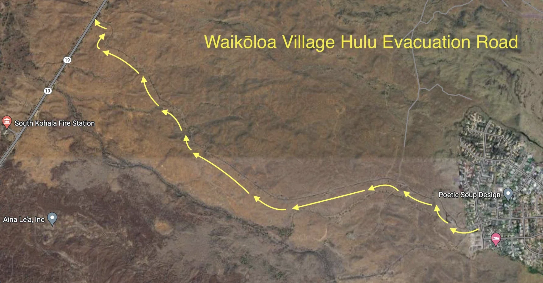
Map shows the route of an emergency road in the Waikōloa area on Hawaiʻi Island. Source: Google Maps.
In Conclusion.
This report is a vital step toward accountability and action. It moves the conversation from "we should do something" to "here is exactly what is missing." For the safety of our community, we must demand that our leaders treat these findings not as a conclusion, but as a blueprint for the urgent work that needs to begin immediately.
Read the full article from Hawaiʻi Public Radio here: Hawaii wildfire emergency evacuation routes